| |
|
|
 |
| |
 |
| |
| |
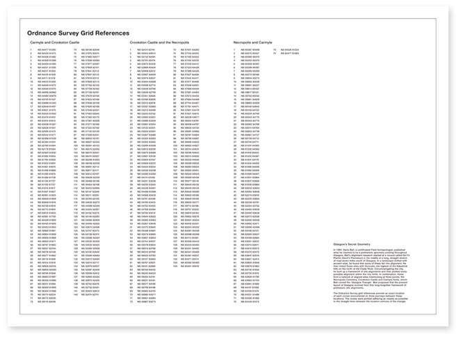
In 1984, Harry Bell, a certificated Field Archaeologist, published what he claimed to be a prehistoric geometry existing throughout Glasgow. Bell’s alignment research started at a mound called De’il’s Plantin (Devil’s Plantation) in the middle of a long, straight stretch of road seven miles south of Glasgow. In a landscape dotted with ancient sites, he found that some of these fell into alignment. He then linked up these sites with Duncolm, the highest of the Kilpatrick hills on the north of the Clyde River. Circumnavigating the city, he built up a framework of site alignments and then plotted every possible alignment within the city limits. In combination, these form a network of aligned sites interlocking at three points; the Necropolis Cemetery, Crookston Castle and Carmyle fords, which Bell coined the ‘Glasgow Triangle’. It was proposed by Bell that the present layout of Glasgow has evolved from this long-forgotten framework of prehistoric site alignments.
The Ordnance Survey grid references provide an exact location of each corner encountered on three journeys between these locations. The routes were plotted adhering as closely as possible to the straight lines between the location vertices of the triangle.
|
|
|
|
|